Table of Contents
Loved what you read? Share it with others!
Hosa Road Metro Station Bangalore: Map, Routes, Stations & Localities to Live in 2026
Updated : February 11, 2026, 6:45 AM
Author :
![]() Suju
Suju
Table of Contents
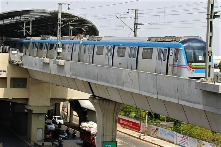
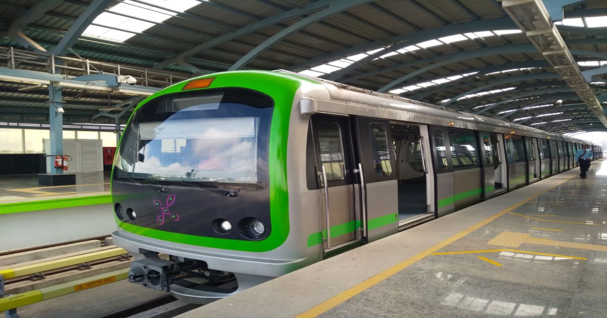
Hosa Road Metro Station, Bangalore, is located on the Yellow Line of the Namma Metro, operated by the Bangalore Metro Rail Corporation Limited (BMRCL). The Yellow Line was inaugurated on August 10, 2025 and began operation for the public on August 11, 2025. The station has two platforms with modern facilities, including lifts, ramps, restrooms, a ticket counter, and parking. It is located near the Hosa Road junction and links RV Road to Bommasandra, passing through major areas such as BTM Layout, Central Silk Board, Kudlu Gate, and Electronic City. Interchanges include RV Road (Green Line) and upcoming links at Jaydeva Hospital (Pink Line) & Central Silk Board (Blue Line). The property prices near the Yellow Line metro have also increased by 10% due to increased demand and proper connectivity. The metro is a fast, affordable, and convenient way to commute.
Hosa Road Metro Station - Quick Information
Hosa Road metro station, situated on the Yellow Line of Namma Metro, is an elevated station that provides smooth, affordable, and eco-friendly travel with proper connectivity across South Bangalore. The table below will give detailed information about the station:
| Details | Information |
| Name | Hosa Road Metro Station |
| Other name | Hosa Road (Hosur Road Corridor) |
| Operator | Bangalore Metro Rail Corporation Limited (BMRCL) |
| Inauguration Date | August 10, 2025 (Available to the public from August 11, 2025) |
| Route | RV Road- Bommasandra (Yellow Line) |
| Type | Elevated Metro Station |
| Number of Platforms | 2 |
| Interchange stations | RV Road (Green Line), Jayadeva Hospital (future Pink Line), Central Silk Board (future Blue Line) |
| Structure | Elevated, Double Track |
| Ticket price | ₹10 to ₹70 |
| Parking facilities | yes |
| Divyang Friendly | yes |
| Timing | 6:30 to 11:55 [1] |
| Frequency | 8 to 10 minutes |
| Daily Ridership | 25,000+ |
| Other facilities | Smart card recharge, CCTV, ATM, Escalators, route maps |
| Future Development | Upcoming pink & blue line interchanges |
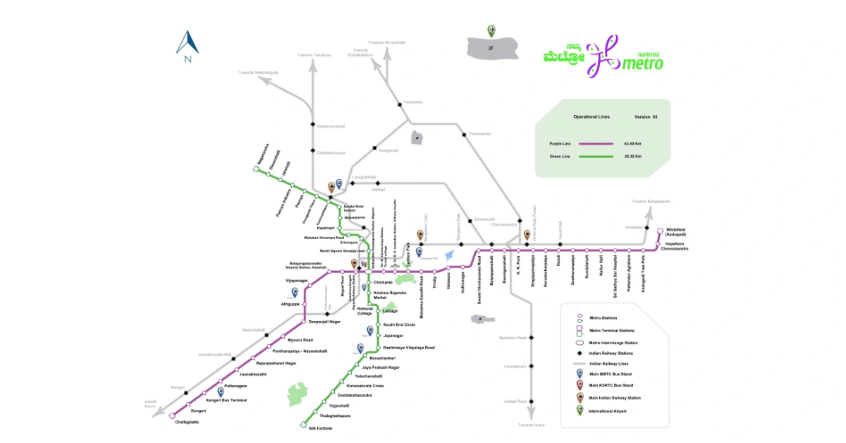
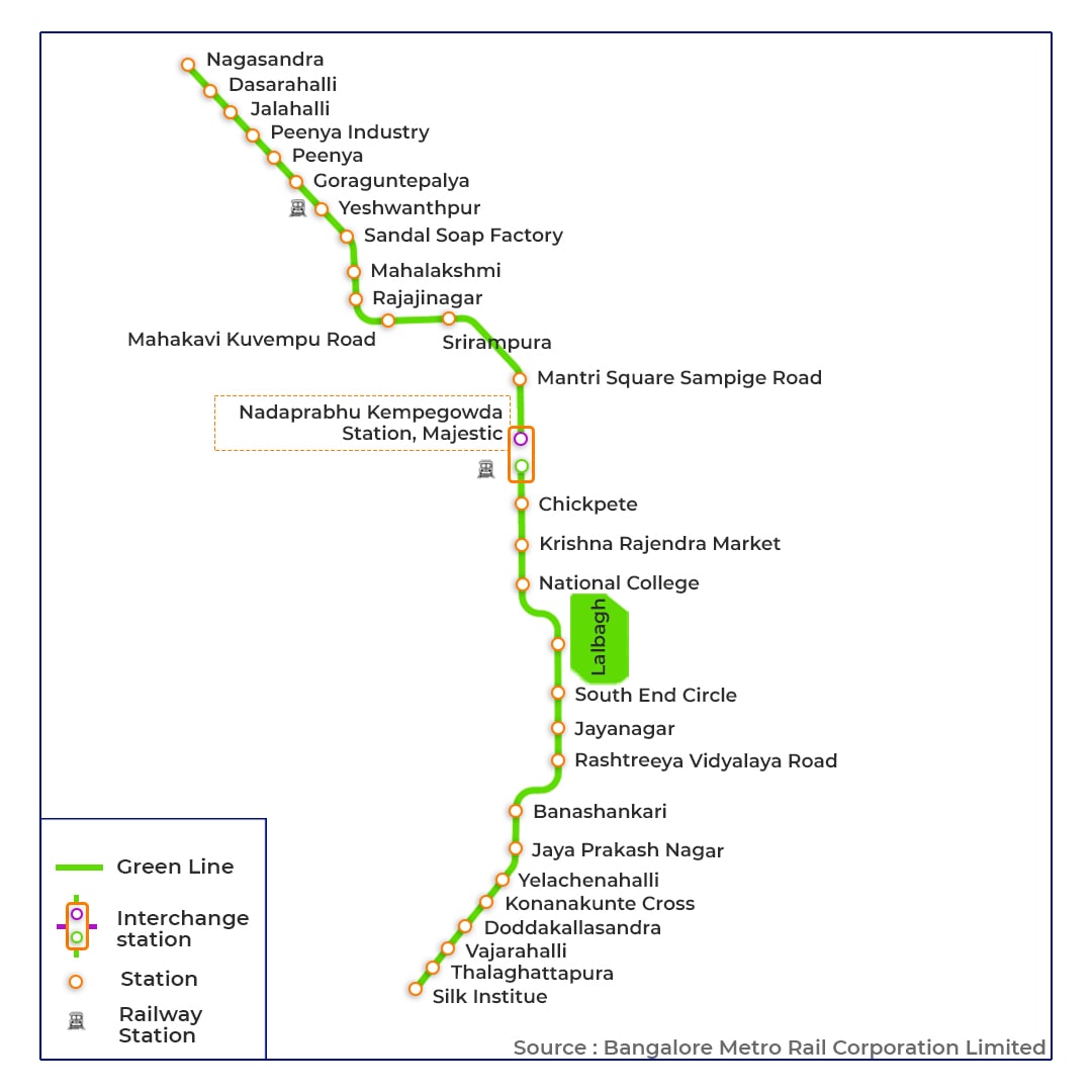
Hosa Road Metro Station Map
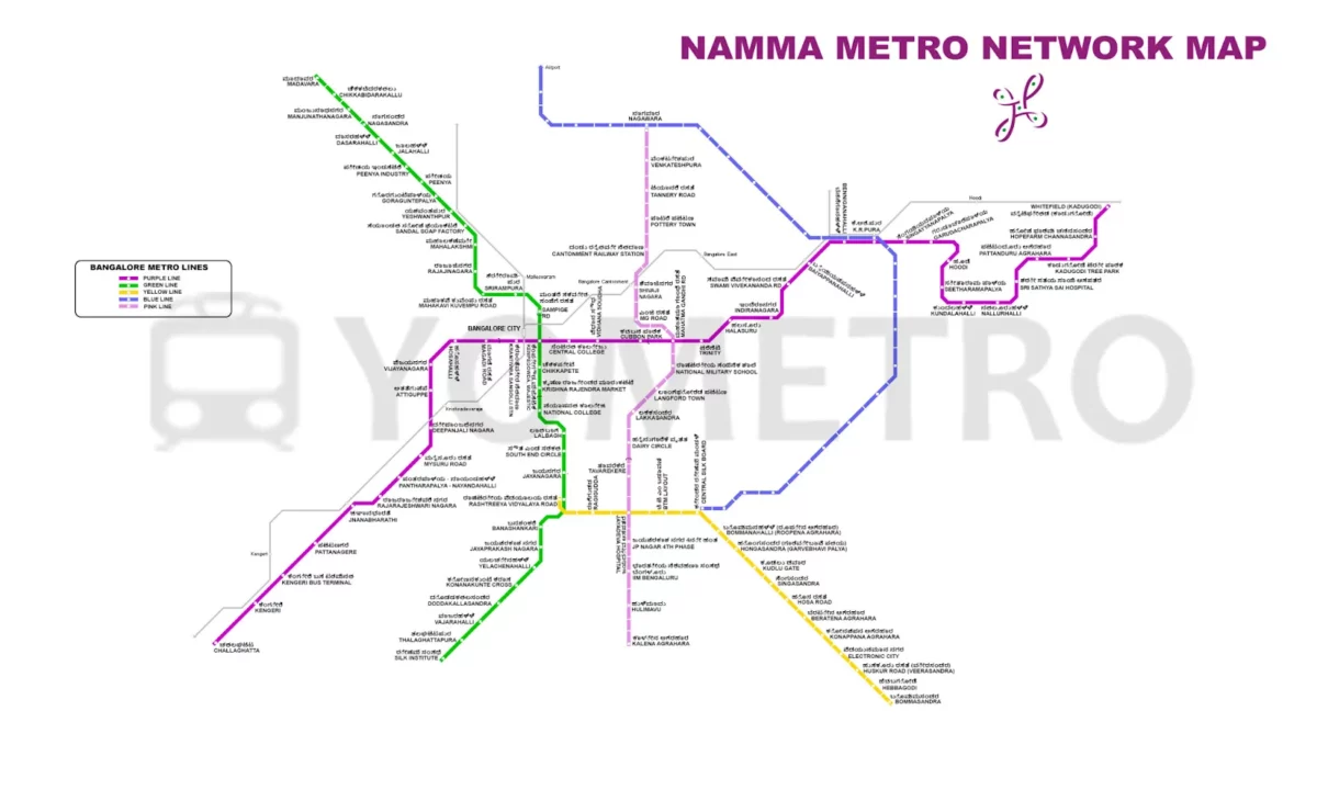
The Hosa road metro station map shows its location on the yellow line of Namma metro, nearby stations, interchanges and connectivity. The map highlights routes to RV Road and Bommasandra, linking them with green lines. The Hosa road metro station route map helps passengers plan their travel, check interchanges and other timings.
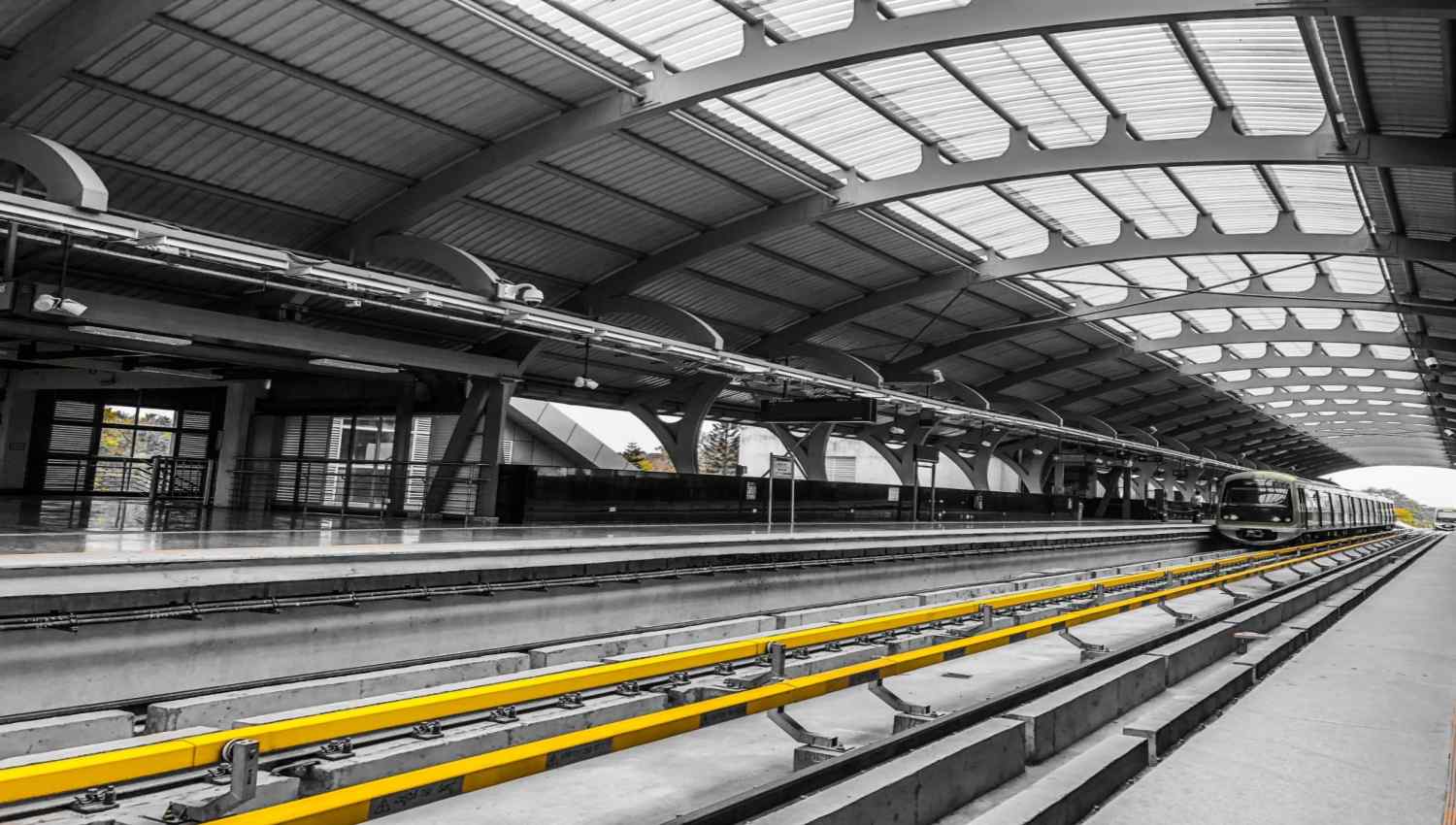
Hosa Road Metro Station Platform Details
Hosa Road Metro Station features two elevated side platforms, designed to facilitate a smooth passenger flow. Platform 1 serves the train towards RV Road, while Platform 2 connects to Bommasandra. The platform has clean signage and accessibility features that make traveling easy and convenient.
Hosa Road Metro Station list towards Rashtreeya Vidyalaya Road (RV Road) (Platform 1)
From Hosa Road Metro Station platform 1, trains head towards Rashtreeya Vidyalaya Road, stopping at Bommanahalli, BTM Layout, Central Silk Board and more.
- Hosa Road
- Singasandra
- Kudlu Gate
- Hongasandra
- Bommanahalli
- Central Silk Board(Future Interchange with Blue Line)
- BTM Layout
- Jayadeva Hospital(Future interchange with Pink Line)
- Ragigudda
- Rashtreeya Vidyalaya Road (RV Road)
Hosa Road Metro Station list towards Bommasandra (Platform 2)
From Hosa Road Metro Station platform 2, trains head towards Delta Electronics Bommasandra, stopping at Electronic City, Huskur Road, Biocon Hebbagodi, and more.
- Hosa Road
- Beratena Agarhara
- Electronic City
- Infosys Foundation Konappana Agrahara [4]
- Huskur Road
- Biocon Hebbagodi
- Delta Electronics Bommasandra
Hosa Road Metro Station to Hosa Road distance
The Hosa Road metro station is strategically named and located to serve the Hosa Road area. The station structure is on Hosur Road (NH44), near the Hosa Road junction. Therefore, the metro station distance from the actual Hosa Road junction is essentially zero, providing direct access. The distance will naturally increase for destinations further along Hosa Road, which extends towards Sarjapur Road; however, the station serves as the primary metro gateway for the entire Hosa Road catchment zone.
Hosa Road Metro Station Timings Details
Hosa Road Metro station operates daily from approximately 6:30 am to 11:22 pm. [1]. The frequency of the train in peak hours is 5 to 10 minutes, and 15 to 20 minutes in non-peak hours. The table below will show you the details:
| Details | Timing |
| First train Hosa Road to RV Road | 6:30 am |
| Last Train Hosa Road to RV Road | 11:22 pm |
| First train Hosa Road to Bommasandra | 6:30 am |
| Last train Hosa Road to Bommasandra | 11:22 pm |
Hosa Road Metro Station Ticket Fares
Travelling from the Hosa Road metro station is budget-friendly. Passengers can buy single journey tokens, smart cards to get 5% discount, and can also opt for group tickets [2] to get a 10% discount for 25+ people. The tokens must be used within 30 minutes of purchase. Smart cards are the best option because they save time. The table below will show the distance and the prices:
| Distance Travelled | Regular Fare | Smart Card Fare |
| 0-2 | 10 | 9.50 |
| 2-4 | 20 | 19 |
| 4-6 | 30 | 28.50 |
| 6-8 | 40 | 38 |
| 8-10 | 50 | 47.50 |
| 10-15 | 60 | 57 |
| 15-20 | 70 | 66.50 |
| 20-25 | 80 | 76 |
| 25-30 | 90 | 85.50 |
| Above 30 | 90 | 85.50 |
Final fare charts will be displayed at the station and available online once the service is operational.
Hosa Road Metro Station Entry & Exit Points
Hosa Road metro station has multiple entry and exit points, each equipped with ticket counters, smart card recharge machines and escalators. These gates provide easy access to nearby residential areas, offices and main roads for easy commuting.
Hosa Road Metro Station Parking Details
The Hosa Road metro parking [3] facility provides safe and affordable options for people. With dedicated spaces for two-wheeler, four-wheeler, and light vehicles, it ensures convenient access for daily travellers. The table below will give the detailed price:
| Vehicle Type | Up to 4 hours | Each additional hour | Maximum daily rate |
| Two-wheelers | ₹15 | ₹5 | ₹35 |
| Four-wheelers (cars) | ₹30 | ₹10 | ₹60 |
| Light Commercial Vehicles | ₹75 | ₹25 | ₹150 |
Note: Overnight parking is not available.
Connectivity with Other Transport Modes in Bangalore Metro
Bangalore Metro ensures smooth connectivity with other transportation modes, including BMTC buses, Ola/Uber, Rapido autos, and cabs, at all major metro stations.
Hosa Road Metro Station Route Details 2026
Hosa Road metro station, opened on August 10, 2025, is located on the Yellow Line of Namma Metro, connecting RV Road to Bommasandra. Positioned between Singasandra and Agraha, it links Kudlu and Electronic City. With interchanges to the green and blue lines, it ensures smooth and convenient travelling.
Connecting Hosa Road Metro Station to Rashtreeya Vidyalaya (RV Road) Metro Station
To travel from Hosa Road metro station to RV Road metro station, people will need to board the yellow line from platform 1 towards RV Road. There are no interchanges, and this covers about 8 kilometres with 10 stations, taking around 15 minutes. It is a smooth and convenient journey. The reverse trip of the RV road to the Hosa road metro follows the same route with similar timing.
| Details | Information |
| Time of First Metro | 5:00 AM |
| Time of Last Metro | 11:30 PM |
| Travelling Time | 15 minutes |
| Total Distance | 8 kilometers |
| Number of Stops | 10 |
| Interchange | 0 |
| Fare of Token | ₹40 |
| Fare of Smart Card | ₹38 (5% off) |
| Platform | 1 |
Nearby Places at the RV Road Metro Station
- Lal Bagh Botanical Garden
- Bangalore Military School
- Iskcon Temple
- Tipu Sultan’s Summer Place
- Cubbon Park
Connecting Hosa Road Metro Station to Whitefield (Kadugodi) Metro Station
To travel from Hosa Road metro station to Whitefield (Kadugodi Tree Park station), commuters will need to take the Yellow Line towards RV Road, interchange to the Green Line towards Nagasandra at RV Road, and interchange again at Majestic to the Purple Line towards Whitefield (Kadugodi). This estimated journey is 70-90 minutes and covers around 45-50 km.
| Detail | Projected Information / Basis for Estimation |
| Time of First Metro | 5:00 AM (Based on standard network start time) |
| Time of Last Metro | 11:00 PM / 11:30 PM (Based on standard network end time) |
| Travelling Time | 70 - 90 minutes (Estimate including interchanges and wait times) |
| Total Distance | 45 - 50 km (Estimate) |
| Number of Stops | ~ 40 (Estimate including stations on Yellow, Green & Purple Lines) |
| Interchange | Required (2 Interchanges: RV Road [Yellow/Green] & Majestic [Green/Purple]) |
| Fare of Token | ₹90 (Projected maximum Namma Metro fare cap) |
| Fare of Smart Card | ₹65 (Projected, based on 5% discount) |
| Platform | Hosa Road: Platform towards RV Road |
Nearby Markets and Places at Whitefield (Kadugodi):
- Park Square Mall
- Forum Shantiniketan Mall
- ITPL (International Tech Park Bangalore) Vicinity
- Kadugodi Market
- Inorbit Mall Whitefield
Connecting Hosa Road Metro Station to Baiyappanahalli Metro Station
Reaching Baiyappanahalli Metro Station from Hosa Road involves taking the Yellow Line towards RV Road, changing to the Green Line at RV Road towards Nagasandra, and then switching to the Purple Line at Majestic towards Baiyappanahalli/Whitefield. This trip is estimated to take 60-75 minutes, covering roughly 30-33 km.
| Detail | Projected Information / Basis for Estimation |
| Time of First Metro | 5:00 AM (Standard Namma Metro start time) |
| Time of Last Metro | 11:00 PM / 11:30 PM (Standard Namma Metro end time) |
| Travelling Time | 60 - 75 minutes (Estimate including interchanges) |
| Total Distance | 30 - 33 km (Approximate route distance) |
| Number of Stops | ~ 28 [Est: Hosa Rd-RV Rd (~13 Yellow) + RV Rd-Majestic (5 Green) + Majestic-Baiyappanahalli (10 Purple)] |
| Interchange | Required (2 Interchanges: RV Road [Yellow/Green] & Majestic [Green/Purple]) |
| Fare of Token | ₹80 (Estimate based on distance, likely capped at ₹60) |
| Fare of Smart Card | ₹76 (Estimate with 5% discount) |
| Platform | Hosa Road: Platform towards RV Road |
Nearby Markets and Places at Baiyappanahalli:
- Gopalan Signature Mall
- Baiyappanahalli Local Market
- SMVT Railway Terminal
- Old Madras Road commercial establishments
- Benniganahalli Lake
Connecting Hosa Road Metro Station to Vijayanagar Metro Station
To get to Vijayanagar Metro Station from Hosa Road, take the Yellow Line towards RV Road, change to the Green Line at RV Road towards Nagasandra, and then switch at Majestic to the Purple Line towards Challaghatta. This journey covers about 24-27 km and is expected to take 50-65 minutes.
| Detail | Projected Information / Basis for Estimation |
| Time of First Metro | 5:00 AM (Standard Namma Metro start time) |
| Time of Last Metro | 11:00 PM / 11:30 PM (Standard Namma Metro end time) |
| Travelling Time | 50 - 65 minutes (Estimate including interchanges) |
| Total Distance | 24 - 27 km (Approximate route distance) |
| Number of Stops | ~ 22 [Est: Hosa Rd-RV Rd (~13 Yellow) + RV Rd-Majestic (5 Green) + Majestic-Vijayanagar (4 Purple)] |
| Interchange | Required (2 Interchanges: RV Road [Yellow/Green] & Majestic [Green/Purple]) |
| Fare of Token | ₹70 (Estimate based on distance) |
| Fare of Smart Card | ₹66 (Estimate with 5% discount) |
| Platform | Hosa Road: Platform towards RV Road |
Nearby Markets and Places at Vijayanagar:
- Vijayanagar Market (Clothing, household goods, food)
- Vijayanagar TTMC & Shopping Complex
- Maruti Mandir
- Attiguppe Market (nearby)
- Local eateries along Chord Road
Connecting Hosa Road Metro Station to Indiranagar Metro Station
The commute from Hosa Road to Indiranagar Metro Station involves the Yellow Line towards RV Road, the Green Line from RV Road to Majestic, and then the Purple Line from Majestic towards Whitefield. This trip, covering approximately 28-31 km, is estimated to take 55-70 minutes.
| Detail | Projected Information / Basis for Estimation |
| Time of First Metro | 5:00 AM (Standard Namma Metro start time) |
| Time of Last Metro | 11:00 PM / 11:30 PM (Standard Namma Metro end time) |
| Travelling Time | 55 - 70 minutes (Estimate including interchanges) |
| Total Distance | 28 - 31 km (Approximate route distance) |
| Number of Stops | ~ 26 [Est: Hosa Rd-RV Rd (~13 Yellow) + RV Rd-Majestic (5 Green) + Majestic-Indiranagar (8 Purple)] |
| Interchange | Required (2 Interchanges: RV Road [Yellow/Green] & Majestic [Green/Purple]) |
| Fare of Token | ₹80(Estimate based on distance, likely capped at ₹60) |
| Fare of Smart Card | ₹76 (Estimate with 5% discount) |
| Platform | Hosa Road: Platform towards RV Road |
Nearby Markets and Places at Indiranagar:
- 100 Feet Road (Boutiques, Restaurants, Pubs)
- CMH Road (Shops, Eateries)
- Indiranagar BDA Complex (Market)
- Numerous Cafes and Fine Dining Restaurants
- Retail outlets of major brands
Connecting Hosa Road Metro Station to KR Puram (Krishnarajapura) Metro Station
To reach Hosa Road Metro to KR Puram Metro Station, take the Yellow Line towards RV Road, then interchange to the Green Line at RV Road, then to the Purple Line at Majestic towards Whitefield. This route covers approximately 31-37 km and takes 65-80 minutes.
| Detail | Projected Information / Basis for Estimation |
| Time of First Metro | 5:00 AM (Standard Namma Metro start time) |
| Time of Last Metro | 11:00 PM / 11:30 PM (Standard Namma Metro end time) |
| Travelling Time | 65 - 80 minutes (Estimate including interchanges) |
| Total Distance | 31 - 37 km (Approximate route distance) |
| Number of Stops | ~ 30 [Est: Hosa Rd-RV Rd (~13 Yellow) + RV Rd-Majestic (5 Green) + Majestic-KR Puram (12 Purple)] |
| Interchange | Required (2 Interchanges: RV Road [Yellow/Green] & Majestic [Green/Purple]) |
| Fare of Token | ₹90 (Estimate based on distance, likely capped at ₹60) |
| Fare of Smart Card | ₹85 (Estimate with 5% discount) |
| Platform | Hosa Road: Platform towards RV Road |
Nearby Markets and Places at KR Puram:
- KR Puram Market (Near Railway Station)
- Phoenix Marketcity (Short distance away on ORR)
- IT Parks along Outer Ring Road (ORR)
- KR Puram Lake
- Local eateries and shops
Connecting Hosa Road Metro Station to JP Nagar Metro Station
Travelling to JP Nagar Metro Station from Hosa Road requires taking the Yellow Line towards RV Road and interchanging onto the Green Line southbound at RV Road station. Hosa Road metro station distance to JP Nagar Metro Station is a shorter 18-22 km trip, estimated to take 35-50 minutes.
| Detail | Projected Information / Basis for Estimation |
| Time of First Metro | 5:00 AM (Standard Namma Metro start time) |
| Time of Last Metro | 11:00 PM / 11:30 PM (Standard Namma Metro end time) |
| Travelling Time | 35 - 50 minutes (Estimate including interchange) |
| Total Distance | 18 - 22 km (Approximate route distance) |
| Number of Stops | ~ 16 [Est: Hosa Rd-RV Rd (~13 Yellow) + RV Rd-JP Nagar (3 Green)] |
| Interchange | Required (1 Interchange: RV Road [Yellow/Green]) |
| Fare of Token | ₹60 (Estimate based on distance) |
| Fare of Smart Card | ₹57 (Estimate with 5% discount) |
| Platform | Hosa Road: Platform towards RV Road |
Nearby Markets and Places at JP Nagar:
- Central Mall, JP Nagar
- JP Nagar 6th Phase Market area
- Bannerghatta Road Commercial Establishments (nearby)
- Numerous Restaurants and Cafes
- Sarakki Lake / Puttenahalli Lake (nearby)
Connecting Hosa Road Metro Station to Kundalahalli Metro Station
Reaching Kundalahalli Metro Station from Hosa Road involves taking the Yellow Line to RV Road, the Green Line to Majestic, and the Purple Line towards Whitefield. This longer journey covers approximately 37-41 km and might take 70-90 minutes.
| Detail | Projected Information / Basis for Estimation |
| Time of First Metro | 5:00 AM (Standard Namma Metro start time) |
| Time of Last Metro | 11:00 PM / 11:30 PM (Standard Namma Metro end time) |
| Travelling Time | 70 - 90 minutes (Estimate including interchanges) |
| Total Distance | 37 - 41 km (Approximate route distance) |
| Number of Stops | ~ 35 [Est: Hosa Rd-RV Rd (~13 Yellow) + RV Rd-Majestic (5 Green) + Majestic-Kundalahalli (17 Purple)] |
| Interchange | Required (2 Interchanges: RV Road [Yellow/Green] & Majestic [Green/Purple]) |
| Fare of Token | ₹90 (Projected maximum Namma Metro fare cap) |
| Fare of Smart Card | ₹85 (Projected, based on 5% discount) |
| Platform | Hosa Road: Platform towards RV Road |
Nearby Markets and Places at Kundalahalli:
- Kundalahalli Gate Market Area (Junction with shops, eateries)
- Brookefield Mall (nearby)
- Cosmos Mall (nearby)
- Hypermarkets and Supermarkets
- Numerous IT Parks and Restaurants
Best Areas to Live Near Hosa Road Metro Station
Living near the upcoming Hosa Road Metro Station offers exceptional connectivity via the Yellow Line. The surrounding neighbourhoods blend growing infrastructure with essential amenities, making it ideal for IT professionals, families, and investors. Here are some of the top residential areas near the station:
1. Hosa Road Vicinity/Junction, Bangalore
- Distance from station: 0-1 km
- Property types: Multi-storey Apartments, Plotted Developments, Commercial-Residential Mix
- Key features: Direct walkable metro access, proximity to Hosur Road amenities, and a rapidly developing hub.
- Average Rent (Estimates): Rents can vary. Expect 1 BHKs around ₹10,000 - ₹18,000. Newer 2 BHK apartments might range from ₹25,000 - ₹40,000+, while 3 BHKs could be ₹35,000 - ₹55,000+.
2. Basapura, Bangalore
- Distance from station: 1-2 km
- Property types: Apartments, Independent Houses
- Key features: Very close to the station, excellent access to NICE Road and Electronic City.
- Average Rent (Estimates): 1 BHK units may range from ₹9,000 - ₹16,000. 2 BHKs are likely in the ₹20,000 - ₹35,000 range, with some newer complexes higher.
3. Singasandra, Bangalore
- Distance from station: 1-2 km (Next station towards RV Road)
- Property types: Large Apartment Complexes, Gated Communities
- Key features: Established residential area, good social infrastructure nearby, and next to a station.
- Average Rent (Estimates): Being established, 1 BHKs might start from ₹12,000 - ₹20,000. 2 BHKs typically range from ₹25,000 - ₹45,000. 3 BHKs in larger gated communities often start from ₹40,000 - ₹60,000+.
4. Begur, Bangalore
- Distance from station: 1-4 km (Wider area)
- Property types: Diverse Mix (Apartments, Independent Houses, Plots, Villas)
- Key features: Blend of established & developing zones, potentially quieter areas available, good road connectivity.
- Average Rent (Estimates): Offers a wide spectrum. Basic 1 BHKs might be ₹8,000 - ₹15,000. 2 BHKs can range broadly from ₹18,000 - ₹35,000. Villas or larger independent houses will command significantly higher rents.
5. Parappana Agrahara, Bangalore
- Distance from station: 2-3 km
- Property types: Apartments, Independent Houses
- Key features: Established residential locality, often offers relatively affordable housing options.
- Average Rent (Estimates): Known for relative affordability. 1 BHKs could be around ₹7,000 - ₹14,000. 2 BHKs often fall between ₹15,000 - ₹28,000.
6. Electronic City Phase 1, Bangalore
- Distance from station: 3-5 km (Via Metro/Road)
- Property types: Large Gated Communities, Premium Apartments
- Key features: Ideal for E-City employees, these integrated townships feature schools, hospitals, and shops within.
- Average Rent (Estimates): Generally higher due to E-City premium. 1 BHKs might start ₹15,000+. 2 BHKs often range from ₹30,000 - ₹50,000+. Premium 3-4 BHKs in top complexes can easily exceed ₹60,000 - ₹1,00,000+.
7. Naganathapura, Bangalore
- Distance from station: 2-4 km
- Property types: Apartments, Plotted Developments
- Key features: Developing area along Hosa Road, presence of newer projects, good investment potential.
- Average Rent (Estimates): Similar or slightly lower than Hosa Road Junction. 1 BHKs possibly ₹9,000 - ₹17,000. 2 BHKs likely ₹22,000 - ₹38,000, depending heavily on the specific project.
Why Invest Near Hosa Road Metro Station?
Here are the key reasons why investing near the Hosa Road Metro Station is wise for homebuyers and property investors in Bangalore.
1. Convenience & Connectivity
Residents near Hosa Road Metro Station will significantly benefit from the Yellow Line's seamless connectivity, particularly to the Electronic City IT hub, the RV Road interchange (connecting to the Green Line), and the Silk Board interchange (connecting to the Blue Line - Airport Line). This strategic location is expected to significantly reduce commute times compared to relying solely on road transport, especially during peak hours. Access to Hosur Road and proximity to NICE Road further enhance overall connectivity.
2. Property Value Boost
As observed across Bangalore, proximity to operational metro stations typically boosts property value appreciation rates. The Yellow Line has been fully functional since August 11, 2025, and the properties within a 1-2 kilometre radius of Hosa Road are already witnessing appreciation due to improved connectivity. The direct link to Electronic City makes this corridor particularly attractive for rental demand and capital appreciation potential, appealing to end-users and investors.
3. Target Audience & Property Types
The areas surrounding Hosa Road Metro Station cater to a diverse range of residents:
- IT Professionals: Studio, 1, and 2 BHK apartments are ideal due to their direct access to E-City.
- Families: 2-3 BHK apartments in gated communities (Singasandra, E-City, newer projects in Begur/Naganathapura) offering amenities.
- Investors: Plotted developments (Hosa Road Vicinity, Naganathapura, parts of Begur) and apartments showing potential for rental yield and appreciation.
- Budget-Conscious: More affordable options are likely in Parappana Agrahara or older parts of Begur.
How NoBroker Can Help?
NoBroker is a trusted platform that makes finding a house near the Hosa Road metro station and other localities in Bangalore affordable. With zero brokerage charges, users directly connect with property owners. The platform offers varied listing smart filters for budget, amenities, and 24/7 customer support. Services like rental agreement, packers and movers, and home loan make it a one-stop solution. Millions of people trust NoBroker for its convenience and reliability.
Frequently Asked Questions
Ans: Yes, the Hosa Road metro station has started. It was inaugurated on August 10, 2025, by Prime Minister Narendra Modi.
Ans: Hosa Road metro station is on the Namma Metro Yellow Line (RV Road – Bommasandra).
Ans: Parking facilities (Hosa Road metro station parking) are planned for two- and four-wheelers. Details on capacity and exact fees will be available upon opening.
Ans: Currently (before the Yellow Line opens), the nearest metro station to Hosa Road junction would likely be a station on the Green Line, like Rashtreeya Vidyalaya Road (RV Road) or Banashankari, or potentially Silk Institute (Green Line south end), which requires road transport to reach Hosa Road. Once operational, the Hosa Road station will be the direct metro access.
Ans: The Electronic City station is just 2 stops away from Hosa Road station on the Yellow Line (towards Bommasandra), making the Hosa Road metro station distance to Electronic City very short via the metro.
Recommended Reading
Bangalore Metro: Map Route, Timings, Lines, Stations List and Updated News 2026
May 4, 2025
489432+ views

Purple Line Metro Bangalore: Routes, Maps and Timings and Fares
May 1, 2025
271201+ views
Yellow Line Metro Bangalore: Route, Map Timings, Stations and Fares in 2026
May 2, 2025
258475+ views
The Green Line Metro Bangalore: Routes, Maps, fares and Nearby Residential Areas
April 10, 2025
225576+ views
Yeshwanthpur Metro Station Bangalore: Map, Routes, Parking, Facilities, and Travel Tips 2026
January 7, 2025
171860+ views
Most Viewed Articles
Bangalore Metro: Map Route, Timings, Lines, Stations List and Updated News 2026
May 4, 2025
489432+ views
Top 12 Richest Cities in India: Population, Area, GDP and Ranking in 2026
March 13, 2025
355535+ views
Purple Line Metro Bangalore: Routes, Maps and Timings and Fares
May 1, 2025
271201+ views
Yellow Line Metro Bangalore: Route, Map Timings, Stations and Fares in 2026
May 2, 2025
258475+ views
The Green Line Metro Bangalore: Routes, Maps, fares and Nearby Residential Areas
April 10, 2025
225576+ views
 Author
Loved what you read? Share it with others!
Recent blogs in
Sarojini Nagar Metro Station, Routes, Fares, Amenities, and Nearby Areas in 2026
March 18, 2026 by Suju
List of 10 Best Schools in HSR Layout, Bangalore: Annual Fees, Board and Facilities for 2026-27
March 9, 2026 by NoBroker.com


 Full RM + FRM support

Join the conversation!